Showing posts with label Mountain. Show all posts

Tuesday, May 13, 2025

Bridges in the Mist: Narrow Crossings Over a Seasonal Mountain River

Bridges in the Mist: Narrow Crossings Over a Seasonal Mountain River

 Bridges in the Mist: Narrow Crossings Over a Seasonal Mountain River

A Tale of Two Bridges: Crossing the Seasonal Stream

There is something uniquely poetic about bridges. More than just functional structures, they represent passage, progress, and connection. In this image, we witness a pair of narrow bridges stretching across a modest seasonal river, quietly embedded in a lush, hilly landscape. At first glance, the picture might seem ordinary—a pair of crossings over a stream. But for those who pause to observe more deeply, this scene is rich with meaning, history, and subtle beauty.

Nestled amidst dense greenery and soft undulating hills, the setting brings a serene calm. The bridges—one a metallic truss structure designed for vehicles and another a more rustic pedestrian path—serve as reminders of the ingenuity it takes to connect people across challenging terrains. The foliage seems to envelop the scene, softening the edges of industrial effort with nature's own intricate designs.

From the top left corner of the image, a stone staircase hints at human activity—perhaps a family venturing to a nearby hamlet or simply crossing to the other side. The people in bright clothing add a hint of scale, reminding us how small humans appear when juxtaposed with the vastness of the landscape.

The Engineering Challenge of Narrow Bridges

Building bridges in hilly terrain is a demanding task. Engineers must navigate not just the geographical challenges of uneven ground and flowing water, but also the ecological balance of the region. Unlike urban environments where machinery and workforce can be deployed en masse, mountain bridges are often crafted through limited accessibility and local labor.

The bridges in the photograph appear narrow—just wide enough for essential travel. These aren’t major commercial crossings. They’re lifelines for the communities who use them, often the only connection between a village and the nearest town. In many mountain regions across the world—from the Himalayas to the Andes—these narrow bridges are built not out of grand ambition, but sheer necessity.

Moreover, the river they span is seasonal. During monsoons or snowmelt, it swells and flows powerfully, requiring that bridges be built high enough and strong enough to withstand the deluge. During dry months, it may dwindle to a trickle. But one never underestimates the potential fury of water flowing down from high hills.

The Beauty of Simplicity in Mountain Infrastructure

These bridges lack grand arches or dramatic towers. Instead, they reflect simplicity, economy, and purpose. Constructed using common materials like steel and concrete, with visible trusses and plain railings, the design is utilitarian but durable. Yet, in the context of their environment, they exude a quiet charm.

There’s a rhythmic symmetry in the metal beams, an understated elegance in the way the bridge spans the ravine. And with the green hills rising in the background and thick foliage framing both ends, the entire scene becomes a portrait of harmony between man-made and natural worlds.

The older pedestrian bridge, likely used by villagers and perhaps even livestock, tells a story of age and time. You can imagine schoolchildren walking across it, or elders pausing midway to rest and gaze down at the water. It may creak underfoot, yet it continues to hold steadfast.

Life Around Narrow Bridges

In mountain towns, such bridges are more than infrastructure. They are community meeting points, resting stops, and even markers of local folklore. Children may play along their rails, couples might pause for quiet conversations, and travelers often stand at the middle to soak in the view. These crossings often connect not just landmasses, but also moments in time—stories passed down from one generation to another.

In many parts of the world, locals recall tales of how bridges were built—community efforts where villagers carried materials on foot, piece by piece, across difficult paths. Some bridges are dedicated to local deities or are believed to be lucky or cursed depending on who you ask. And still today, they endure as humble testaments to resilience and cooperation.

Abstract Beauty: Nature and Steel

From an abstract point of view, this image holds rich contrasts. There’s the softness of the forested hills and the hard geometry of the bridges. The dark metallic greys of the trusses stand out sharply against the lush green backdrop. A seasonal stream winds through—a reminder of change—while the sturdy bridges represent permanence.

This interplay between permanence and impermanence is what gives the image depth. The riverbed may change with the seasons, the vegetation may bloom or wither, but the bridges hold strong. Their function is consistent, but their context shifts subtly every day.

Photographically, the framing is gentle, drawing the eye from the lower corner where the pedestrian bridge starts, up toward the vehicular bridge, and eventually toward the distant staircase. It feels like a visual journey—crossing the water, climbing the hill, disappearing into the trees.

The Global Context: Narrow Bridges Around the World

Across the globe, narrow bridges have served communities in silent yet profound ways. In Bhutan, bamboo footbridges sway above roaring rivers. In Peru, villagers still weave rope bridges by hand each year, preserving ancient Incan traditions. In Japan, narrow railway bridges slice through misty valleys, often seen in poetic art. In Scotland, old stone bridges curve over brooks on winding roads between lochs.

What ties them together is a shared essence—they are built where necessity outweighs luxury, where function determines form, and where beauty arises not from ornamentation but from authenticity.

This image, though modest in its scope, belongs to that global gallery of meaningful crossings. It is at once a local detail and a universal motif.


🌉 Need This Image for Stock or Creative Use?

If you're interested in using this image for stock photography purposes, or as part of a creative project like a printed poster, greeting card, t-shirt, travel brochure, or website background, please feel free to leave a comment on this post or contact me directly. I will get back to you with high-resolution files and terms of commercial usage.

This image is perfect for themes such as:

  • Mountain travel and remote infrastructure

  • Bridges and crossings

  • Abstract contrasts of steel and nature

  • Serenity and solitude in rural design

  • Sustainable living and minimalist engineering

Whether you’re working on a print campaign, a travel blog, or a design series focusing on rural engineering or tranquil landscapes, this image could serve as a powerful visual cue.


Let this image remind you that even the smallest bridges can carry the heaviest stories.

Want to improve your photos? Buy Photoshop and see how your images come to life. Click to buy.

Want to get tips for improving your photography ? Get Photo Tips from this blog.
Friday, November 23, 2018

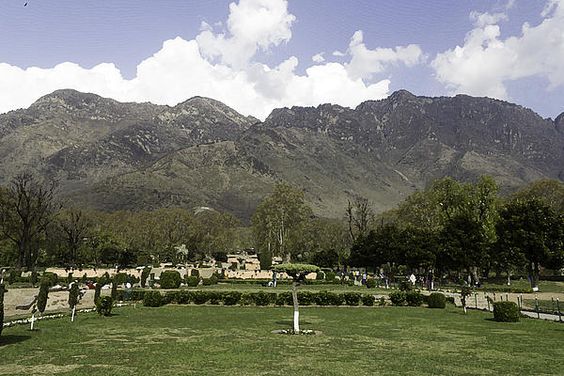
Shalimar Bagh, Srinagar: A Timeless Mughal Garden Overlooking Dal Lake - Prints on Fine Art America

Introduction

Nestled on the northeastern shores of Dal Lake in Srinagar, Jammu and Kashmir, Shalimar Bagh stands as a testament to Mughal horticultural prowess and romantic expression. Commissioned in 1619 by Emperor Jahangir for his beloved wife, Empress Nur Jahan, this garden, also known as Farah Baksh ("The Delightful"), embodies the essence of Persian garden design adapted to the unique topography of Kashmir.

Historical Background

While the site of Shalimar Bagh has ancient roots, with references to a garden built by King Pravarsena II in the 2nd century, it was Emperor Jahangir who transformed it into the magnificent garden we see today. In 1619, captivated by Kashmir's beauty, Jahangir expanded the existing garden to create a royal retreat for Empress Nur Jahan. Later, in 1630, under Emperor Shah Jahan's reign, the garden was further extended by Governor Zafar Khan and renamed Faiz Baksh ("The Bountiful") .

Architectural Layout

Shalimar Bagh spans approximately 31 acres and is structured into three distinct terraces, each serving a specific purpose:

Diwan-e-Aam (Public Audience Hall): The lowest terrace, accessible to the public, features a black marble throne set against a backdrop of cascading water.

Diwan-e-Khas (Private Audience Hall): The middle terrace, reserved for the emperor's private gatherings, showcases intricate stone pavilions and a central water channel lined with fountains.

Zenana Garden (Ladies' Garden): The uppermost terrace, secluded and serene, was designated for the royal women. It houses the famed black pavilion surrounded by a pool and features niches (chini khanas) that once held oil lamps, illuminating the waterfalls at night .

A central canal, known as the Shah Nahar, flows through the garden, connecting all three terraces and eventually merging with Dal Lake. This waterway, adorned with numerous fountains, enhances the garden's tranquility and reflects the Mughal emphasis on symmetry and aesthetics.

Botanical Highlights

Shalimar Bagh is renowned for its lush greenery and diverse flora. The garden is adorned with majestic chinar trees, known for their vibrant foliage that changes with the seasons. In spring, the garden bursts into a riot of colors with blooming flowers, while autumn paints the landscape in hues of red and gold. The meticulously maintained lawns, flowerbeds, and tree-lined pathways offer visitors a serene environment to relax and rejuvenate.

Cultural Significance

Beyond its architectural and botanical beauty, Shalimar Bagh holds cultural and historical importance. It served as the royal court during the Mughal era, where emperors held court sessions and entertained guests. The garden's design reflects the Mughal philosophy of creating paradise on earth, blending natural beauty with architectural elegance. Today, it stands as a symbol of Kashmir's rich heritage and continues to attract tourists, historians, and nature enthusiasts alike.

Visiting Shalimar Bagh

Location: Northeastern shore of Dal Lake, Srinagar, Jammu and Kashmir, India.

Timings: Open daily from 9:00 AM to 7:00 PM (timings may vary seasonally).

Entry Fee: A nominal fee is charged for entry; photography is usually permitted without additional charges.

Best Time to Visit: Spring (March to May) and Autumn (September to November) are ideal for witnessing the garden's floral beauty and vibrant foliage.

Accessibility: The garden is easily accessible by road and is approximately 15 kilometers from Srinagar city center.

Nearby Attractions

  • Nishat Bagh: Another exquisite Mughal garden located nearby, known for its twelve terraces and panoramic views of Dal Lake.

  • Chashme Shahi: A smaller Mughal garden famous for its natural spring and terraced lawns.

  • Pari Mahal: A historic monument offering a blend of Islamic architecture and breathtaking views of Srinagar.

  • Dal Lake: The iconic lake offers shikara rides, houseboat stays, and picturesque views, enhancing the overall experience of visiting Shalimar Bagh.

Bringing Shalimar Bagh Home

If you're captivated by the beauty of Shalimar Bagh and wish to bring a piece of it into your home, consider purchasing prints or merchandise featuring images of the garden. These items, available on platforms like Fine Art America, include wall art, home décor, and accessories that celebrate the garden's timeless elegance.

If you like this image and want a print of this wonderful garden, please buy from my Fine Art America store, and also check out my other images / art.

Want to improve your photos? Buy Photoshop and see how your images come to life. Click to buy.

Want to get tips for improving your photography ? Get Photo Tips from this blog.

Tuesday, November 20, 2018

Glacier down the mountain in Sonmarg - Facebook post

Glacier down the mountain in Sonmarg - Facebook post
The glacier sliding down the slope of a mountain near Sonmarg in Kashmir in North India. This is during the month of April when the ice and snow have started melting and road clearing has started. However, there are many such locations where these rivers of ice exist, they will vanish in another month leaving behind only traces that there was so much ice. Looks beautiful and some of them were used for sledding.

Also available on Facebook at this link.

Beautiful print of the ice and snow of Sonmarg. http://bit.ly/1E4VDKl

Sonamarg is very beautiful, both in winter and summer (although getting here in the depth of winter can be pretty difficult because of the ice covering the roads).

Want to improve your photos? Buy Photoshop and see how your images come to life. Click to buy.

Want to get tips for improving your photography ? Get Photo Tips from this blog.

Tuesday, November 13, 2018

Taking the sled to the top in Sonmarg - Kashmir

Taking the sled to the top in Sonmarg - Kashmir
Pulling a sled to the top of a rise in Sonamarg in Kashmir. As the ice starts melting in late-March and April, roads leading to Sonmarg can be cleared of the ice and tourists start heading there, the sport of ice sledding starts taking off, on a small scale. Local people get these wooden sleds and invited tourists to take a trip down a small slope on these sleds, and it can be a lot of fun. #Sonmarg 

Beautiful print of the ice and snow of Sonmarg.http://bit.ly/1E4VDKl

Sonamarg is very beautiful, both in winter and summer (although getting here in the depth of winter can be pretty difficult because of the ice covering the roads).

Want to improve your photos? Buy Photoshop and see how your images come to life. Click to buy.

Want to get tips for improving your photography ? Get Photo Tips from this blog.

Tuesday, September 23, 2014

Beauty of a Loch in the Scottish Highlands along with hills

One of the most famous attractions of Scotland (and the Scottish Highlands) are the numerous Lochs that are present all through (Loch is the Scottish/Irish name for lake). These are formed in different configurations, with some forming along a natural fault in the earth, and others forming on the sides of hills. Typically most Lochs are not very wide, being long and narrow. Many of these Lochs have been kept unspoiled, with the natural outdoors look, and look very beautiful. So, typically you have Lochs along with hills / mountains being very beautiful.


Water of a Loch along with hills in the Scottish Highlands
Water of a Loch along with hills in the Scottish Highlands (More photos here)
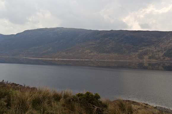
The calm waters of a Loch along with the hill right next to the Loch. The hill (as in previous photos) is covered with scrub / sparse vegetation, and with the rock of the surface of the hill showing. The whole appearance of the hill is that of a beautiful natural outdoors look. If you look closely at the water, you will see the surface of the water seems disturbed for part of the surface, and looks totally calm for the rest of the surface. There is no sign of civilization here, just nature and the unspoiled look of the lake.


The narrow section of a Loch between a hill and the shore on the other side
The narrow section of a Loch between a hill and the shore on the other side (More photos here)
This photo is one of my favorite photos, showing the absolute beauty of the Scottish Highlands. There is the hill with sparse vegetation (showing the rugged nature, since the greenery on the hills is sparse, and it is mostly rocky) and with a Loch right next to the hill. The Loch can be pretty long, but the width of the water is pretty narrow, which is something that I have seen in most of the Lakes that I saw in Scotland. It looks exceedingly beautiful; we had stopped at the side of a highway, and could see this wonderful sight, just standing there at the shore of the lake and enjoying the view, the wind and the calm. 

Want to improve your photos? Buy Photoshop and see how your images come to life. Click to buy.

Want to get tips for improving your photography ? Get Photo Tips from this blog.
Monday, September 22, 2014

Low mountains and hills in the Scottish Highlands, with their scrub

The Scottish Highlands is a beautiful part of Great Britain. Its region of great rugged outdoors, hills and mountains, lochs, and abundant greenery make for a beautiful location to which a large number of tourists want to visit. In addition to a large number of lakes, there is the incredible weather, and castles that dot the region in different places. Some of the places will seem like any other town (although the surroundings will be far more beautiful) while others will seem far more isolated and yet beautiful. For example, the photos below have been taken from a highway passing through the region, showing some of the hills (covered with scrub) in the region.

Hills in the Scottish Highlands, covered with scrub
Hills in the Scottish Highlands, covered with scrub (More photos here)
2 hills in the Scottish Highlands, both covered with scrub. Most of the hills in this region are covered with Scrub, not even grasses or lush vegetation (maybe because of the local weather and soil conditions - if anybody knows the answer, please mention so in the comments). The weather overhead is not yet rainy, but it could change at any instant and become darker and start raining.


Sheer cliff and rocky face of one of the hills in the Scottish Highlands
Sheer cliff and rocky face of one of the hills in the Scottish Highlands (More photos here)
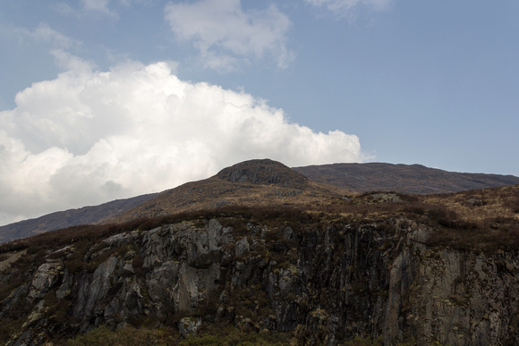
The sheer cliff face of a hill in the Scottish Highlands. The top part of the hill is covered in sparse vegetation, but it looks like the impact of weather or some more sudden event caused the erosion of the cliff face and fall of the side of the hill. This kind of cliff face, although not very high, is something that is treasured by climbers who like this kind of challenge (this particular one would be more used for training rather than for any serious activity).

Want to improve your photos? Buy Photoshop and see how your images come to life. Click to buy.

Want to get tips for improving your photography ? Get Photo Tips from this blog.
Saturday, September 20, 2014

Passing through the mountains of the Scottish Highlands

The Scottish Highlands are a rugged area of Scotland, famous for its mountains and lakes (Lochs). Some of the places are now well settled, so they can hardly be called rugged, but there are large chunks of area that are rugged, and beautiful. Many of these places are easy to visit, with highways passing through them; you just need to step off the highway when you are near a Loch or a mountain and you can see the full beauty of nature in the Highlands. In the following photos, you are actually seeing nature close to the highway which passes through, although if you were not seeing the highway, you would not be easily able to make out that this place is connected to civilization. The presence of lakes also provides a place to enjoy water sports, which can also be seen.


Multiple hills in the Scottish Highlands with wires in front
Multiple hills in the Scottish Highlands with wires in front (More photos)
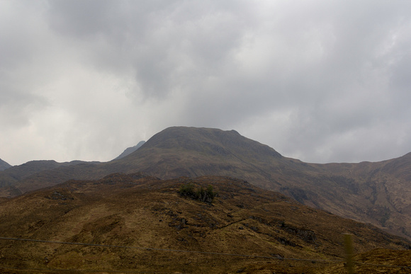
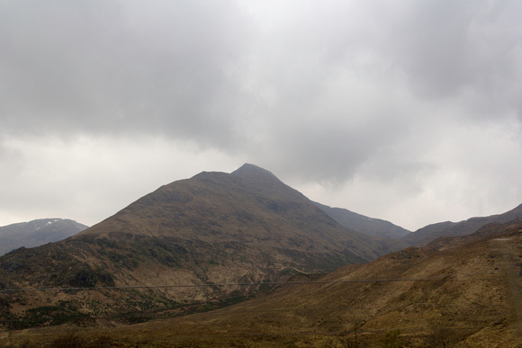
Hills in the Scottish Highlands. These seem sufficiently rugged, with almost no habitation on the hills. The dark clouds overhead complete the notion that this is an outdoors place, as nature intended. However, then you have wires passing in front of the view, which provides proof of the presence of civilization all around you along with the highway on which you are traveling on.


Hill in the Scottish Highlands with scrub and other vegetation
Hill in the Scottish Highlands with scrub and other vegetation (More photos)
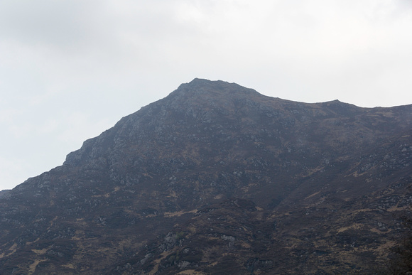
This is a view of a hill in the Scottish Highlands. Even though these hills are not very high, they do not have thick vegetation. The vegetation in this region of the Scottish Highlands is mostly scrub, and on this mountain you can see scrub and exposed rock.


On a highway passing through the Scottish Highlands (More photos / Prints)
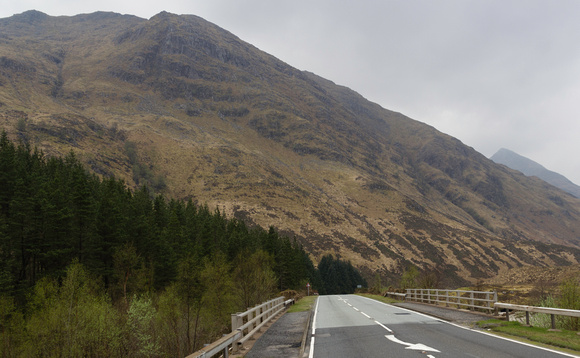
Who would not want to travel on such a road ? A lovely road passing through the Scottish Highlands, with trees, greenery and mountains on one side, and a stream on the other side (this point is actually a bridge). One can keep on driving easily on such a highway (as long as one does not run into any emergency, in which case it could take some time to get help).


Boats in a Loch in the Scottish Highlands
Boats in a Loch in the Scottish Highlands (More photos / Prints)
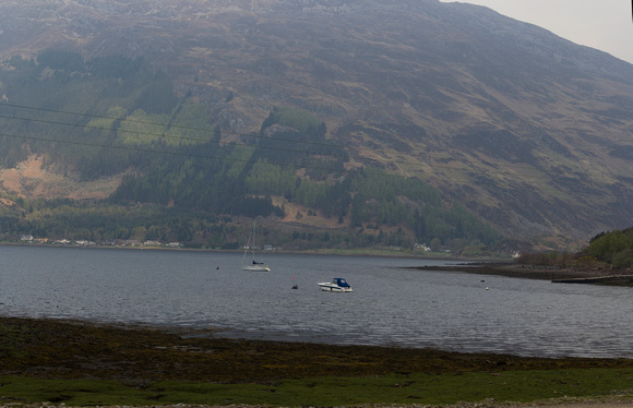
With so many lakes in the Scottish Highlands, recreational facilities are also available in plenty. I don't know which Loch is this, but there are many boats here. On the other side of the loch are houses and other such buildings, and a lot of greenery above the buildings.

Want to improve your photos? Buy Photoshop and see how your images come to life. Click to buy.

Want to get tips for improving your photography ? Get Photo Tips from this blog.
Saturday, June 23, 2012

View of small hillocks while on the route to Abu Simbel in south Egypt

View of small hillocks while on the route to Abu Simbel in south Egypt

The road route from Aswan to Abu Simbel is around 280 km by road, but it takes only around 3 hours for the journey. The journey is mostly uneventful, with a straight road and no obstructions, but in the distance there are hills that are seen from time to time. This is a photo of that journey, somewhere in the middle where there were some hills to be seen in the distance.
The Mysteries of Abu Simbel: Ramesses II
View Larger Map


tourists acrylic prints

Want to improve your photos? Buy Photoshop and see how your images come to life. Click to buy.

Want to get tips for improving your photography ? Get Photo Tips from this blog.
Saturday, May 26, 2012

Occasional change in the terrain as we were driving from Aswan to Abu Simbel in Egypt

Occasional change in the terrain as we were driving from Aswan to Abu Simbel in Egypt

The distance by road from Aswan to Abu Simbel is around 280 km (the actual distance is lower, but you know how road distances tend to be larger than the actual distance). Most of the terrain is flat, but from time to time, there are some hills / mountains on the way, such as can be seen in this photo. However, the route is for the most part, boring. The only interesting element in the road trip was when you are able to catch the orb of the sun at sunrise / sunset.
The Mysteries of Abu Simbel: Ramesses II
View Larger Map


indian prints

Want to improve your photos? Buy Photoshop and see how your images come to life. Click to buy.

Want to get tips for improving your photography ? Get Photo Tips from this blog.
Thursday, January 05, 2012

View of hills in the distance along with the path in front of the Karnak temple in Luxor

View of hills in the distance along with the path in front of the Karnak temple in Luxor
The area in front of the Karnak temple is pretty large. Tourists can come to the parking and from there need to walk to the actual temple, and it is not a short distance (this is the space that you can see in the current photo). In the distance, you can see some hills (and remember, there are hills near Luxor, what with the Valley of the Kings and the Valley of the Queens being actual limestone cliffs).

Want to improve your photos? Buy Photoshop and see how your images come to life. Click to buy.

Want to get tips for improving your photography ? Get Photo Tips from this blog.
Saturday, April 30, 2011

View showing the high cliffs towering over the Hatshepsut mortuary temple in Egypt

Photo - View showing the high cliffs towering over the Hatshepsut mortuary temple in Egypt
The Hatshepsut mortuary temple was built somewhat differently from other mortuary temples. The main reason was the placement of the temple with respect to the high cliffs over it. In this photo, you can see how the high limestone cliffs tower over the temple and, were it not for the magnificence of the temple, the cliffs would seem incredibly beautiful by themselves.

Want to improve your photos? Buy Photoshop and see how your images come to life. Click to buy.

Want to get tips for improving your photography ? Get Photo Tips from this blog.
Friday, March 11, 2011

View of tombs of nobles in the cliffs outside Luxor

View of tombs of nobles in the cliffs outside Luxor
In the region of the Valley of the Kings (and Valley of the Queens), there are a large section of limestone cliffs. These were used to drill into and make tombs for the pharaohs, and in addition, there were tombs made for nobles and relatives of the pharaoh. In this photo, you can see these tombs, typically meant for nobles.
Buy Lonely Planet Guide to Egypt. Click to buy.
Improve your photos, buy Photoshop and see how your images come to life. Click to buy.
Want to get tips for improving your photography ? Get Photo Tips from this blog.

Want to improve your photos? Buy Photoshop and see how your images come to life. Click to buy.

Want to get tips for improving your photography ? Get Photo Tips from this blog.

Saturday, February 05, 2011

Flowers at the Kosi river next to the Corbett National Park in North India

Flowers at the Kosi river next to the Corbett National Park in North India
The Kosi river flows at the back of most of the resorts right outside the Corbett National Park in Uttaranchal in North India. You can see a view of a flower at the banks of the river.

Want to improve your photos? Buy Photoshop and see how your images come to life. Click to buy.

Want to get tips for improving your photography ? Get Photo Tips from this blog.

Subscribe to my feed

FeedRSS